.jpg)
Google Earth allows us to explore most parts of the world without having to move from our desk. When enabling the Google Street View option, big parts of our earth turn into an accessible blue. These Street Views are created by Google Street View cars and other vehicles, as well as by individual contributors. Anyone can upload a Google Street View by creating 360-degree imagery of a place. These individually contributed images hold not only roads, like the Street Views created by Google vehicles, but also businesses, shops, practices and other places.
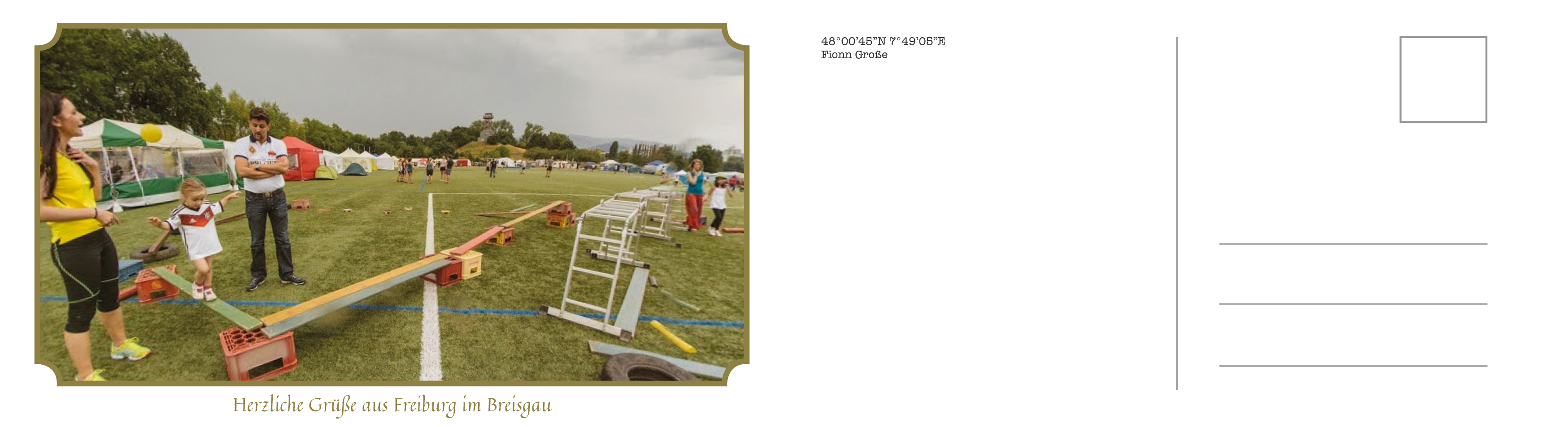
Before visiting Freiburg for the first time, I decided to visit Freiburg online using Google Street View. I found restaurants, shops, hotel rooms, a dentist practice, offices and a bedroom.
These images, that I accessed from my desk, gave me an image of the city completely different from the physical experience of visiting Freiburg. I am a tourist of Freiburg without physically being in the city. I am a tourist flying above the city, hopping from place to place through windows and walls.
Postcards, originally displaying popular and recognisable places in a city, here show the places hidden in the physical city, shown only to the digital tourist.
Rosa Maas (born Helmond, Netherlands, 2002) is a photography student at the Hogeschool voor de Kunsten Utrecht, currently studying media arts at the Hochschule für Gestaltung Karlsruhe as an exchange student. Rosa focuses on the endless media landscape and the images that keep circling around and get intensified in a sea of real and fake. By collecting image samples from our daily (online) lives, Rosa tries to respond in an often ironic way to the absurdity of the digital sphere.


.png)

.png)

.png)
.png)

.png)


.png)
